Monday, May 28, 2007

Bumblebees

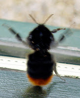
In a recent Berwickshire News there was an article on the decline of the bumble bee. The Bumblebee Conservation Trust based at Stirling University is asking for digital photos of bumblebees with the postcode of where the photograph was taken. If you email it to the address below they will email back with an identification of the type of bee. I emailed two photos of bumblebees taken in our garden and the was indeed emailed back with their identification.


The top left is a common carder (Bombus pascuroum) and bottom right is a red-tailed bumblebee (Bombus Lapidarius)

beewatch@bumblebeeconservationtrust.co.uk

Monday, May 14, 2007

The Bard in The Borders

Two hundred and twenty years ago this month The Bard left Edinburgh on a trip around the Eastern Borders.

It was on 5 May 1787 that Robert Burns and his friend Robert Ainslie, Burns left Edinburgh for a tour of the Borders. Ainslie was the son of the land-steward of Lord Douglas’s Berwickshire Estates, he was born at Berrywell near Duns. Ainslie was a law student in the Edinburgh office of Samual Mitchelson when Burns met him in early 1787. Both men were lovers of wine and women and the odd song so they forged a natural friendship.

Their route lay through Haddington, Gifford, Longformacus, Duns, Coldstream, Cornhill-on-Tweed, back to Coldstream, Kelso, Roxburgh, Jedburgh, Wauchpe, Kelso, Melrose, Dryburgh, Selkirk, Innerleithen, Caddonfoot, Galashiels, Earlston, Duns, Berwick, Eyemouth, Dunbar, Duns, Alnwick, Morpeth, Newcastle, Hexham, Longtown, Carlisle, Annan and Dumfries which he reached on 1 June. At Jedburgh and Dumfries he was made a freeman of the burgh.

Left Edinburgh (May 5, 1787)—Lammermuir hills miserably dreary, but at times very picturesque. Langton Edge, a glorious view of the Merse; reach Berrywell. Old Mr. Ainslie an uncommon character—his hobbies, agriculture, natural philosophy, and politics. In the first he is unexceptionably the clearest-headed, best-informed man I ever met with; in the other two, very intelligent.

Having been south into England they later returned to Duns prior to going to Eyemouth where boh men were made Royal Arch Masons at the local Masonic lodge

Wednesday May 16.—Dine at Dunse with the Farmers’ Club —company, impossible to do them justice— Rev. Mr. Smith, a famous punster, and Mr. Meikle, a celebrated mechanic, and inventor of the thrashing-mill. Thursday, breakfast at Berrywell, and walk into Dunse to see a famous knife made by a cutler there, and to be presented to an Italian prince. A pleasant ride with my friend Mr Robert Ainslie and his sister to Mr. Thomson’s, a man who has newly commenced farmer, and has married a Miss Patty Grieve, formerly a flame of Mr. Robert Ainslie’s. Company, Miss Jacky Grieve, an amiable sister of Mrs. Thomsons, and Mr. Hood, an honest, worthy, facetious farmer in the neighbourhood.

Sunday, May 13, 2007

Ellem Old Inn

This image of Ellem Old Inn dates from 1840, this advert from twelve years later (1852)

The Rathburne Hotel

This advert from August 1950 has the line - 'out of the world and into Longformacus'. Maybe we should adapt it to - 'Into the Lammermuirs to get out of this world.'

Kingside

When you head south out of Gifford and climb up onto the moor there's a new road sign that shows the left turn takes you to Duns, Cranshaws and Kingside. For those who don't know Kingside was a small settlement that was ‘drowned’ when the Whiteadder Water was dammed to make the reservoir in 1968. The old road that ran though what is now the lake can be clearly seen in the picture below. This is outside our community council area but we still think of it as part of our hills.Does anyone have any old photographs of Kingside?

THE HISTORY AND ARCHAEOLOGY OF THE LAMMERMUIR HILLS

Hopefully this will be the first of a series of talks on the the Lammermuir Hills by people with specialist knowledge of a particular subject.

• Did you know the B.6355 used to be the most important road in Scotland?
• What happened at Ellemford on 20th August 1513?
• What are shiels?

Come and find out the answers to these questions and much more

THE HISTORY AND ARCHAEOLOGY OF THE LAMMERMUIR HILLS
A talk by Scottish Borders Council Archaeologist, Rory McDonald

7.30 p.m. Thursday 17th May Cranshaws Village Hall

It’s FREE
Drinks and Nibbles included!

Saturday, May 12, 2007

Wild Flowers

A senior group of walkers (Seventies and over) have been walking the Southern Uplands Way this week. A few of the ladies in the group have been counting the wild flowers. Between Beatock near Moffat and Abbey St Bathans they had counted 64 species. They have promised to let me know if they find anymore between Abbey St Bathans and the coast and possibly a list of all the names.

Sunday, May 6, 2007

1851 Surnames

This is a list of all the surnames of people resident in Cranshaws and Longformacus Parishes in 1851

Allan; Anderson; Atchison; Bell; Bertram; Black; Blackbell; Blythe; Bolton; Brockie; Brokie; Brown; Buckham; Burton; Cairns; Cameron; Chapman; Christison; Cormack; Cowe; Craig; Craik; Craise; Cribbs; Crosbie; Currie; Dale; Darling; Deans; Denholm; Dods; Dougherty; Douglas; Dudgeon; Duncan; Dunn; Edgar; Ferguson; Fitzsimmons; Fleming; Foggo; Forbes; Forsythe; Fortune; Gillie; Gray; Greive; Hall; Hamilton; Hastie; Henderson; Hislop; Hood; Houliston; Hyslop; Ingles; Johnston; Keddie; Kelly; Kilpatrick; King; Kirk; Knox; Laidlaw; Lauder; Laurence; Laurie; Lawson; Logan; Lowrie; Luke; Lunam; Mack; MacKay; Matthew; Mauchlin; McAdam; McLauchlen; McLiesh; McOrvel; Miller; Mitchel; Moffat; Moscrip; Nickel; Niel; Nisbet; Ovens; Owens; Paterson; Phin; Pringle; Purves; Ramsay; Rankin; Rathie; Redpath;Richardson; Robertson; Robinson; Rodger; Scott; Sibbald; Simpson; Sinclair; Skene; Sligo; Smeaton; Smith; Sommers; Spratt; Stobie; Storey; Swan; Tait; Thomson; Turner; Usher; Uterson; Virtue; Walterson; Wanless; Weir; Whitlaw; Wilson; Wood; Young

Many of these names can still be found in the area. John Craik, one of the more unusual surnames, has just cut down one of our trees.

Cranshaws Kirk

When the old parish church of Cranshaws was built is unknown. The original Parish Church was located approximately two hundred yards from Cranshaws Tower. The first mention of the church was in 1275 when ‘Craneshaues’ Church was listed in Bagimond’s Roll. In 1296 Robert de Strivelin, the vicar of Cranshaws, swore the oath of fealty to Edward 1 at Berwick-upon-Tweed. A new church was eventually built in 1739 on the site of the present day church.

The ruin of the old kirk can just be seen behind the wall in the centre of the picture

The foundations of the old church can still be seen with one or two courses of masonry still in place. Although overgrown with surrounding shrubbery etc the gravestones at the Old Cranshaws Parish Church remain in a reasonable condition.

The eighteenth century kirk was not constructed very well and was in constant need of repair, but did manage to survive until 1899 when it was re-built to provide the current kirk.

German Bomber Crashes in the Lammermuirs in 1939


In late October 1939 pilots of the Auxiliary Air Force shot down this Heinkel HE III bomber. It crashed on the top of the Lammermuir Hills not far from Mayshiel. According to the Scotsman.
“The Nazi was obviously engaged on a lone reconnaissance, and as soon as he was intercepted he at once responded with sustained bursts of machine-gun fire. At the outset, the bomber endeavoured to exploit the usual enemy flying technique, with which, incidentally, Scots airmen are now becoming familiar. It was unavailing. The Heinkel was harried on all sides by the fighters, and he was relentlessly pursued over the broad fields of the Lothians. He had little chance of escape. Individual aircraft went in to the attack, guns blazing. Their dives might be likened to the "stoops" of a hawk at an unfortunate quarry.
The ground on which the ’plane lay riddled with bullets, is about seven or eight hundred feet above sea level, and commands, a wide view of the Firth of Forth and the Pentland Hills. If the wounded pilot, after he first struck the ground had had any thoughts of rising again he must have been daunted by the sight of the Lammermuirs, which formed a solid barrier in his way. When the news that the bomber had been brought down began to circulate men and women, taken with a desire to see an invading craft at close quarters, made their way on foot or by motor car to the moor, until the scene, with its parked vehicles and the crowd on the knoll above them, had all the appearance of some country coursing meeting. Many of those who gathered about the wrecked machine, which they were prevented from approaching at close quarters by a guard, had seen the concluding stages of the fight. They had followed the chase across country, as if they had been following a pack of hounds.”

Population Through Time

The population of the Cranshaws, Ellemford & Longformacus Community Council area is just below 300 people. Below are the figures for the same area which showed that it has halved since it's peak around the turn of the 19th century.

Longformacus - the parish's population through time:
• 1755 - 399
• 1791 - 452
• 1801 - 406
• 1811 - 444
• 1821 - 402
• 1831 - 425
• 1861 – 448
• 1871 - 452
• 1881 - 385
Cranshaws
• 1755 - 214
• 1791 - 164
• 1801 - 166
• 1811 - 186
• 1821 - 156
• 1831 - 136
• 1861 – 134
• 1871 - 142
• 1881 - 106
There was a noticable drop in population between Dr Webster's survey of 1755 and the survey undertaken by the parish minister circa 1791 as part of Sir John Sinclair's Statistical Account of Scotland. The Minister, Rev. George Drummond, explained the drop in population as follows:
"The only reason that can be assigned for this diminution is the monopoly of farms. About 50 or 60 years ago there were above 16 farmers in the parish; the whole is now in the possession of 3 only." From the Statistical Account of Scotland compiled by Sir John Sinclair

The Lammermuir Shiels

The great Border Abbeys at Jedburgh, Kelso and Melrose were established in the twelfth century. Soon after large areas of land in the Lammermuir Hills were gifted to each of theses religious houses for the purposes of farming. The hills then, like now, were used for the rearing of mainly sheep. Many of these monastic farms have the suffix ‘shiel’, which in all likelihood goes back to the days of the pre Christian church.

In the area where the upper streams of the Whiteadder are located, and mainly to the east of the river around Spartleton were the lands held by the Tironensian monks of Kelso Abbey. Eventually their lands ran from the Whiteadder to the Monynut and to Philip’s Burn in the south; this would originally have been called Fulhope Burn. Old records show that the monks of Kelso had “fifty score of sheep and as many pigs as they needed”. What is also interesting is the fact that their lands had very fixed parish boundaries even then.

Millknowe was the place where the monks had their mill, while Mayshiel was granted to the monks of the Isle of May, to the north were lands belonging to the monks of Haddington. Between Penshiel Hill and the Kilmade burn was land that belonged to the Cistercian monks of Melrose Abbey. At Penshiel stood a vaulted Grange, with a chapel and other outbuildings all within a walled enclosure. The excellent reputation of the sheep from this area lasted for hundreds of years, and well after the demise of the Border Abbeys following the Dissolution of the Monasteries (1545). In A.G. Bradley’s book ‘The Gateway of Scotland’ he writes. “Priestlaw…..a familiar name in every market and fair from Edinburgh to Berwick.” He also says that it was a place of great hospitality for those making the journey on horseback or by trap from Dunbar to the Merse. Even people who the farmer barely knew were expected to pay a visit if they were on the road.

Other Shiels within our area are Gamelshiel, Windshiel, Craig’s Windshiel and Windy Windshiel.

Religious Connections
The place names throughout the hills speak to their strong religious connections. St Agnes, Friarsdyke, Friars Nose, Priestlaw, Nunswells, Kilpallet, Kilmade, Abbey St Bathans, Kirkgate Hill, and Godscroft,

Windy Windshiel, just visable on the skyine, is situated on the B6355 between Ellemford to Duns and is aptly named! It was a fortified farmhouse, the left hand half of it was built in the 16th century and the right hand half in the 17th century.

Listed Buildings

Apparently not too many years ago a man from the council, with a clipboard, came around and started listing buildings. This is a complete list of all the buildings in our community council area.

Listed Grade A
Cranshaws Castle including sundial, covered cell and garden wall
Cranshaws Church including graveyard, gate piers and gates
Longformacus House including ancillary structures, courtyard gate piers, quadrant wall, aailings, gate piers and gates and the dovecot


Listed Grade B
Cranshaws Farm, gateway to stable
Cranshaws Schoolhouse including boundary wall and gate piers
Ellemford Bridge
Ellem Lodge including boundary wall, gate piers and gates
Kettleshiel Farm including Farmhouse, former cattle court, garden wall, ancillary structures and boundary wall
Longformacus Church (Church Of Scotland) including lamp stand, graveyard and boundary wall
Longformacus House, walled garden including greenhouse, sundials, piers, stair and gates
Smiddyhill Bridge
Whitchester House, main entrance including quadrant wall, railings, piers, gate piers, gates and turning point
Whitchester House, walled garden including Stair, gate piers and gate, greenhouses, Outer wall and gate piers
Whitchester Lodge and west gate


Listed Grade C
Achray Cottage, Longformacus
Broombank, Cranshaws
Byrecleuch, former Beater's Cottage, originally associated with old shooting lodge
Caldra Farmhouse including garden wall
Craigie Lodge including ancillary structures, boundary wall and gates
Cranshaws Farmhouse including sundial
Cranshaws Manse including outbuildings and garden wall, boundary wall, gate piers and gates
Ellemhaugh Smithy including house, ancillary structure (former hen house, byre and stable) and former smithy
Horseupcleuch Farmhouse including boundary wall
Horseupcleuch Farm steading including former millhouse, former farmhouse and Shepherd's Cottage
The Lodge, Longformacus House
Longformacus Bridge
The Millhouse including garden wall, gate piers and gates
Redpath Farmhouse including boundary wall
Riverside Cottage including boundary wall
1 The Row including cobbled pavement
4 The Row Longformacus including cobbled pavement
The Row, Longformacus Dye Neuk including cobbled pavement
5 The Row Longformacus including cobbled pavement
6 The Row Longformacus including cobbled pavement
12 The Row Longformacus including cobbled pavement
The Row, Longformacus The Honey House including cobbled pavement
13 The Row, Longformacus Gardener's Cottage including cobbled pavement
Woodside Cottage, Ellemford, including sundial

Friday, May 4, 2007

This Could Be The Start of Something....

We've decided to kick start our web site for the Lammermuir Hills with a blog. In time it will be good to transfer the material on this blog to a proper local area web site but in the meantime this will get us on the road to somewhere!

This picture was taken shortly before the Second World War and shows the view looking east from the Ellemford Bridge up the Whiteadder River - pronounce Whit adder. For the curious there's also a Blackadder river.